- Location
- Navajo Nation/Hopi Reservation/Arizona
- Current protection
- Coal Mine Canyon, Ha Ho No Geh Canyon, Blue Canyon
- Status
- No active campaign; tribal land
- In the book
- Featured in Undiscovered America
Why should it be a National Park?
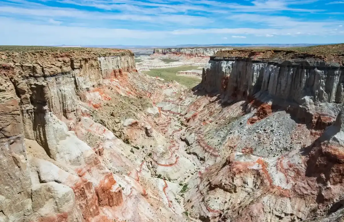
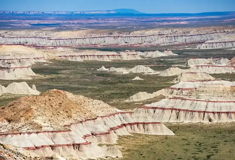
The Moenkopi formation is a geologic layer found in the American southwest that was laid down around 240-million-years-ago. The rocks from this period are mostly like the red rocks found in the Colorado Plateau desert, but incredible and strange outliers are particularly common in a virtually ignored section of north-central Arizona.
Northern Arizona is one of the most visited areas of the country, with popular tourist attractions, such as; Monument Valley, Grand Canyon, Petrified Forest, Wupatki, Sunset Crater Volcano, Lake Powell, and Canyon de Chelly. If you have ever visited any of these sites, you have likely driven by a handful of shockingly beautiful and unknown natural wonders that are still waiting to be discovered. This area is even unknown to most travelers and Arizona residents.
The defining features of these lands are Coal Mine Canyon, Ha Ho No Geh Canyon, and Blue Canyon, which does not resemble the nearby red rock desert that has become synonymous with Arizona. Instead, they boast a color palette of pale blues, whites, browns, yellows, pinks, purples, and greens. This portion of the Moenkopi formation has an array of canyons, painted deserts, fossils, and buttes. However, since it has no paved roads and is not publicized, only a select few know these amazing canyons exist.
The Navajo and Hopi Indian Reservations own and manage this landscape. They do not actively advertise the landscape, and alternatively, they do not advocate much for its protection. Scarce references to Coal Mine Canyon are available in the "parks" section of the Navajo Tourism Department website, but none of the Moenkopi sites mentioned above even have a Wikipedia page (as of this writing). I did not discover these painted canyons until I stumbled upon a local website while researching for this book. Even on this website, there was no fanfare for these exceptional locations.
The easiest way to access the region is by traveling 15 miles east of Tuba City, AZ along highway 264. There are no signs or markings, even though at points during the drive, you are less than a half-mile from the rim of Coal Mine Canyon; it is almost impossible to discern. Along the sparsely populated road, sporadic buildings and the occasional small windmill pop up in the distance making you feel that the dirt roads leading to the canyon will take you to someone's house rather than overlooks. Because of this uninviting environment, it takes an adventurous spirit to turn onto these dirt roads and look for the canyon edge, but once you find the canyon, you will receive a reward of breathtaking views. Currently, the canyons average less than 20 visitors a day, so tourists looking for a chance to escape the crowded atmosphere of the Grand Canyon or Monument Valley have the rare opportunity to be alone with one of the most beautiful and obscure settings in the desert southwest.
A park here would be Navajo and Hopi led, and the template already exists a hundred miles east. Canyon de Chelly is a unit of the National Park System sitting entirely on tribal trust land: the Navajo Nation holds title, families still farm the canyon floor, and the Park Service interprets and protects without owning an acre of it. Nothing in that arrangement is a lesser version of a park. It is a better one, and it is the arrangement these canyons deserve.
The land itself carries that history in its boundaries. The 1882 executive order that created the Hopi Reservation, the 1934 Navajo boundary act, and the 1974 settlement that partitioned the shared land and moved thousands of families are all written into this map, and the relocation that followed is within living memory. An outside proposal drawn across it, however well meant, arrives in the middle of an argument that is not over.
So the question here is not whether the landscape measures up. Coal Mine Canyon and Blue Canyon stand with anything in the Colorado Plateau, and they would be on every list of the country's great places if they were on public land instead of sovereign land. The work is in the partnership: a proposal raised by the nations, negotiated as equals, and co-managed afterward, on the Canyon de Chelly model or the Bears Ears one. The title should follow the landscape, and the landscape has earned it.
The history of National Park Campaigns
Nothing. No federal, state, or tribal park proposal of any kind has been recorded for these canyons; they lie on Navajo and Hopi trust land (Coal Mine Mesa sits astride the 1974-partitioned Navajo–Hopi boundary) and have never been federal public domain.
- Distinct National Park attempts
- 0 / 0
Sources
- Navajo–Hopi land-dispute literature (Benedek, The Wind Won't Know Me)
- 1882
Hopi Reservation executive order
- 1934
Navajo Boundary Act
- 1974
Navajo–Hopi Land Settlement Act (Hopi Partitioned Lands around Coal Mine Mesa). No park proposals found