- Location
- Kentucky/Tennessee
- Current protection
- Daniel Boone National Forest, Big South Fork National River and Recreation Area
- Status
- No active campaign
- In the book
- Featured in Undiscovered America
Why should it be a National Park?
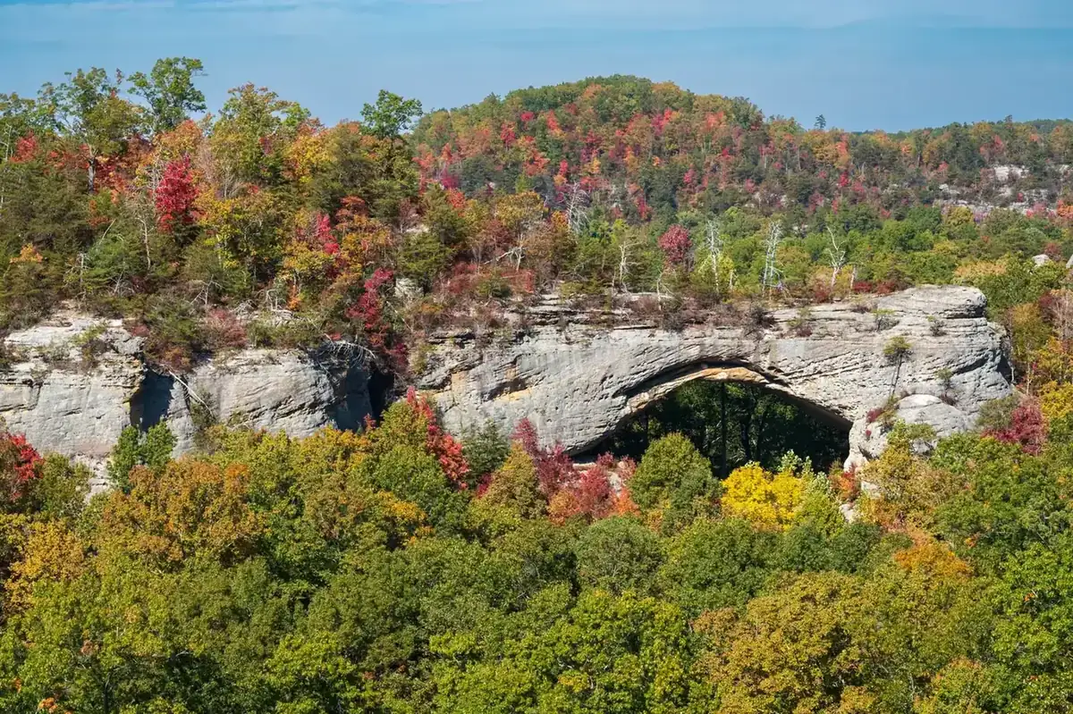
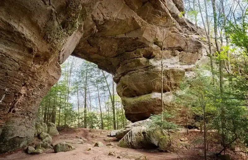
When you think of rock arches and natural bridges, most will inevitably picture the red rock sandstone formations of Utah in Arches National Park, but the Cumberland Plateau region of eastern Kentucky and Tennessee will broaden your view of where these rock formations can be found in the United States. It's a little piece of the southwest in the southeast. The plateau is a tableland of sandstone and shale features that contain one of the highest concentrations of rock arches anywhere in the world, and by far the most in the eastern United States.
The region stands 1,000 feet above the neighboring Tennessee Valley. The thick forests covering the Cumberland area and a natural labyrinth of canyons and river gorges that were carved over the last 500 million years have long concealed and preserved the stone features that define the region. This has made it easy for the landscape to hide its greatest secrets. There are hundreds of known and named arches, waterfalls, and other stone formations with new sites worth visiting being discovered all the time by hikers and backcountry adventurers.
The central factor that kept this area secret and undisturbed is location. The terrain was impassable until relatively recent in our history, therefore, highways and other major roads have largely bypassed the plateau in favor of easier routes. Even now it remains shockingly unknown despite its close proximity to the cities of Knoxville, Nashville, Louisville, and Lexington. By comparison, in 2016 only 684,715 people visited the natural wonders found on the Cumberland Plateau, while nearby Great Smoky Mountains National Park (2 hours southeast by car) received a record 11.3 million visitors.
The scale and beauty of the Cumberland Plateau is certainly deserving of greater visibility and annual visitation. However, the region's complex land management makes this difficult to achieve. In 1937, Cumberland National Forest was established (later renamed Daniel Boone National Forest) to protect wooded sections of the plateau within the state of Kentucky. Further conservation efforts led to the creation of the adjacent Big South Fork National River and Recreation Area in 1974 to extend the protections into northern Tennessee. Although the USFS and NPS manage these lands respectively, their dual-stewardship makes it difficult to combine their missions and create greater awareness and accessibility to the Cumberland Plateau.
National forests, while important, care for significantly more lands than the NPS and allow their acreage to be altered for a number of purposes, including resource extraction. Instead, National Parks are meant for interpretation and preservation. A comprehensive and assembled Cumberland Plateau National Park that highlights the breathtaking river gorges, rock cliffs, formations, and arches would put this rural section of the south on the map as a clear tourist destination and further protect the lands from exploitative practices.
The history of National Park Campaigns
Nobody ever filed a "Cumberland National Park" bill, but the plateau's two signature preservation victories were both won against dams: Cumberland Falls (1927–31, saved as a state park by T. Coleman du Pont after the Kentucky Senate refused a park in 1928) and the Big South Fork (a Corps dam at Devils Jump that the Senate approved five times and the House rejected five times, before Sens. Baker and Cooper substituted a first-of-its-kind National River and Recreation Area in 1974). The Corps of Engineers' own history is explicit that the result was deliberately not a National Park, even though locals and the Corps called it "the Yellowstone of the East."
- Distinct National Park attempts
- 0 formal (booster rhetoric only)
- Other designation attempts
- 8+ (1928 state-park vote; 1931 state park; RDA 1935–44; NF 1937; NHP 1940; NRRA 1974; W&S 1976/1993; wilderness 1985)
Sources
- USACE Nashville District, Engineers on the Twin Rivers / "National River and Recreation Area" chapter (usace.contentdm.oclc.org)
- Tennessee Encyclopedia, "Big South Fork NRRA"
- FPC, Cumberland Falls Project (S. Doc. 189, 1928)
- Kentucky State Parks, Cumberland Falls history
- NPS Big South Fork administrative records
- 1923
Indianapolis investors (Cumberland Hydro-Electric Power Co.) apply to the Federal Power Commission for three Cumberland River dams, including one on the South Fork. (Univ. of Kentucky, ExploreUK)
- 1927–28
Hydroelectric plans at Cumberland Falls; 1928 FPC report on the Cumberland Falls project (S. Doc. 189, 70th Cong., 2d sess.); 1928 a proposal to accept the falls as a park "was brought to the floor of the Kentucky Senate but was defeated." (Wikipedia, Cumberland Falls; UNT catalog)
- 1930
T. Coleman du Pont buys ~600 acres around the falls and donates them to Kentucky; August 21, 1931 — Cumberland Falls State Park established (some sources give 1933 legislative designation). Built out by the CCC/WPA. No national-park proposal found.
- 1933
Army Corps of Engineers first proposes damming the Big South Fork. (Tennessee Encyclopedia)
- 1935–44
Fall Creek Falls managed as an NPS Recreational Demonstration Area, then transferred to Tennessee (prior research; VERIFY dates).
- 1937
Cumberland National Forest (renamed Daniel Boone NF, 1966). 1940/1955 — Cumberland Gap NHP authorized/established.
- 1950s–1960s
"Five times during the 1960s, the Senate approved Devils Jump dam, and five times the House rejected it." TVA showed little interest in the power. (USACE Nashville District history, "VII: National River and Recreation Area")
- Late 1960s–1972
Tennessee Citizens for Wilderness Planning and the Big South Fork Coalition (Dr. Leanne Russell, Tom Gentry of Oneida) campaign for a national river and recreation area — not a National Park — and enlist Sen. Howard Baker Jr. (R-TN), who had first favored the dam ("In those days, the way to progress was to build a dam"), and Sen. John Sherman Cooper (R-KY). Baker used a 1972 water-resources bill to block the dam and buy time. (National Parks Traveler, 2008; Laurel Fork history)
- March 7, 1974
Big South Fork National River and Recreation Area created in the Water Resources Development Act of 1974 (P.L. 93-251, §108), signed by Nixon; the Corps, using the dam's appropriation, acquires land and builds facilities; the Corps' history notes the NRRA "is neither the newest, nor is it a National Park... hunting is not permitted in National Parks." (USACE)
- 1975
Red River Gorge dam killed; 1976 — Obed Wild & Scenic River (P.L. 94-486); 1985 — Clifty Wilderness; 1993 — Red River Wild & Scenic.
- August 25, 1991
Corps transfers Big South Fork management to the NPS. (nps.gov/biso)