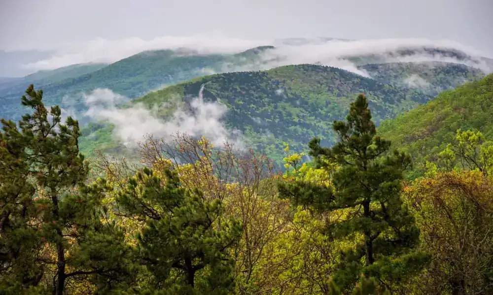
- Location
- Arkansas/Oklahoma
- Current protection
- Petit Jean State Park, Talimena Scenic Drive, Mount Magazine State Park
- Status
- No active campaign
- In the book
- Featured in Undiscovered America
Why should it be a National Park?
The Rocky Mountains mark the western boundary of the Great Plains, and the Appalachian Mountains help define the boundaries of a majority of eastern states. The area between these majestic ranges is unfairly considered flat, boring farmland with little geographical interest. This notion would change if people knew about the dazzling Interior Highlands that lie in between these larger mountain ranges.
"Interior Highlands" is the name collectively given to the Ozarks and Ouachita Mountains, which extend from eastern Oklahoma through northern Arkansas to southern Missouri. Although the nearly 4-million-square-mile region is referred to as mountains, it's actually a dissected plateau–an elevated plain whose mountainous features were carved by erosion and waterways. The resulting terrain is made up of hills that roll on for hundreds of miles.
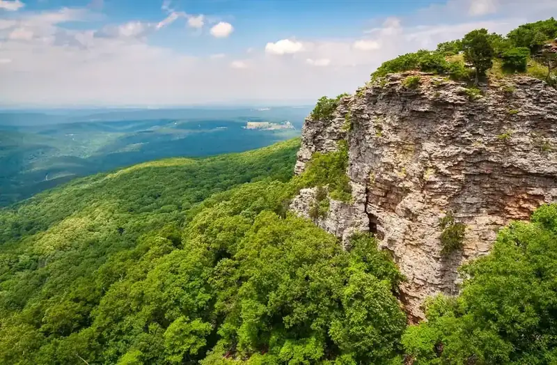
The area's unique natural history is characterized by countless rock overhangs and cliffs overlooking rivers, but almost all of these sites are known only to locals. The Ozarks indeed carry some name recognition with most Americans. Still, few know where to find the mountains on a map, and even fewer have considered vacationing in the region.
The most popular natural sites in the southeast are the Great Smoky Mountains and the Blue Ridge Parkway, which carry surprisingly few similarities to the Interior Highlands. The Ozarks are thought of as a thick, rural thicket of humid woodland, however, the unique geographical features of exposed rock faces and stone formations are in strong contrast to the Appalachians.
The Ouachita Mountains remain a hidden gem. The mountains straddle the border of Oklahoma and Arkansas, making up the southernmost section of the highlands. The most stunning portion of this range is the Talimena Scenic Drive, which extends 54 miles over an impressive series of peaks, providing expansive vistas of both states. Talimena is the biggest missed opportunity in National Park history as legislation establishing the area as a National Park was passed by Congress in the 1920s, only to be pocket vetoed by President Calvin Coolidge. This unfortunate action kept the highlands from becoming one of the iconic natural regions in America.
There are several impressive federal and state protected sites throughout the region, including three national forests. Oklahoma protects the westernmost point of the Talimena range as a state park. A series of parks in Arkansas including Petit Jean and Mount Magazine, the state's highest point, are the best places to experience stunning views and rock formations. Unsurprisingly, the Interior Highlands is also home to Taum Sauk Mountain State Park, the highest point in Missouri. Unifying these interconnected lands would be the best way to put the Interior Highlands on the map, protect the land, and make it a destination for travelers.
Federal legislation was proposed which would have created a National Park in the Ouachita Mountains. While the proposal ultimately passed in Congress, supporters were devastated when President Calvin Coolidge, at the last moment of his presidency, pocket vetoed the legislation.
The history of National Park Campaigns
The Ouachita National Park bill is the closest any place on this list came: introduced by Rep. Otis Wingo on December 5, 1927, backed by Sen. Joseph T. Robinson and Republican state Rep. Osro Cobb, opposed by the Park Service (two inspections — Cammerer's, then Roger Toll's 88-page report complaining of snakes and chiggers), reported favorably by the House Public Lands Committee on February 7, 1929, passed by both chambers, and pocket-vetoed by Calvin Coolidge on his last day in office. Elsewhere in the Highlands, the park impulse produced national rivers rather than parks: the Ozark National Scenic Riverways (1964) and the Buffalo National River (1972).
- Distinct National Park attempts
- 1 (Ouachita, 1927–29) + 1 (Buffalo River, 2023, informal)
- Other designation attempts
- Ozark Rivers NM proposal 1959; ONSR 1964; Buffalo NR 1972
Sources
- House Report 70-2421 (Serial Set 8980)
- Congressional Record Feb.–Mar. 1929
- Roger Toll's Ouachita report (NPS/NARA, 1928)
- Harold Coogan (Mena) collection incl. the 1928 portfolio
- Osro Cobb, Osro Cobb of Arkansas: Memoirs (1989)
- Encyclopedia of Arkansas entries on the Ouachita NF, Buffalo National River
- NPS ONSR administrative history
- 1921
Hot Springs Reservation redesignated Hot Springs National Park — the region's one National Park, and a reason the NPS resisted a second.
- April 29, 1926
Coolidge renames the Arkansas National Forest the Ouachita National Forest and proposes extending it into Oklahoma. (Encyclopedia of Arkansas)
- December 5, 1927
H.R. 5729 (70th Cong.), Rep. Otis Wingo (D-AR), "to establish the Ouachita National Park" — ~160,000–165,000 acres (250 sq mi) between Mena and Glenwood, taking in the headwaters of the Caddo, Cossatot, and Little Missouri; Sen. Robinson's companion (S. 675). Mena, Fort Smith, and Little Rock boosters; a 1928 promotional portfolio. (Arkansas Democrat-Gazette, Tom Dillard, Apr. 26, 2020; AY Magazine)
- 1928
NPS Deputy Director Arno B. Cammerer inspects by train from Mena and reports the park "unacceptable"; NPS then sends Roger Toll, whose 88-page report finds the country "attractive and pretty" but lacking "superlative qualities," and notes "anti-recreational" snakes and chiggers. USDA also opposes. (AY Magazine)
- February 7, 1929
House Report No. 2421 (Mr. Hill of Washington, Committee on the Public Lands) recommends passage of H.R. 5729 with an amendment making the park effective "only when the title to all of the lands within such area and now privately owned shall have been vested in the United States"; the report calls the Ouachitas "the highest range of mountains between the Rocky and Appalachian systems" and says the proposal "is not a local one." (govinfo Serial Set 8980)
- February–March 1929
Congress passes the bill (Senate without a dissenting vote); presented to Coolidge March 1; Osro Cobb meets Coolidge for over an hour; on the morning of March 4, 1929, his last day, Coolidge signs other bills and pocket-vetoes the park. (Senate veto list; Wikipedia, Osro Cobb; Dillard)
- December 3, 1930
Hoover extends the Ouachita National Forest into Le Flore County, Oklahoma — Coolidge's preferred alternative.
- 1959–1964
NPS proposes an "Ozark Rivers National Monument" (Current, Jacks Fork, Eleven Point), which Congress converts into the Ozark National Scenic Riverways (P.L. 88-492, Aug. 27, 1964), the first national river. VERIFY monument-proposal details.
- 1960s–1972
Corps dams proposed on the Buffalo (Lost Valley/Gilbert); Ozark Society (Neil Compton) fights them; March 1, 1972 — Buffalo National River (P.L. 92-237; Rep. John Paul Hammerschmidt, Sens. Fulbright and McClellan). Any "Buffalo National Park" alternative in the 1960s: VERIFY.
- 2023
Walton-linked Runway Group explores a "Buffalo River National Park and Preserve"; withdrawn after fierce local opposition (Jasper town hall, Oct. 26, 2023). (2026 inventory)