- Location
- Maryland/Virginia
- Current protection
- Assateague Island National Seashore, Chincoteague National Wildlife Refuge, Assateague Lighthouse
- Status
- No active campaign
- In the book
- Featured in Undiscovered America
Why should it be a National Park?
There are National Parks protecting the northernmost part of the east coast (Acadia National Park that protects the rocky coastline of Maine) and the southernmost tip of the coast (Biscayne National Park which celebrates Florida's mangrove trees and coral reefs). However, there are no National Parks protecting and celebrating the sandy beaches, forested coastline, and tidal marshes that lie on the stretch of coast between the northernmost and southernmost regions.
When Europeans began colonizing North America, the east coast was mostly undisturbed land, of which very little remains today. Historic sites such as Jamestown, Roanoke, and Cumberland Island commemorate European colonization, but no National Park represents the natural environment that these colonists would have first encountered.
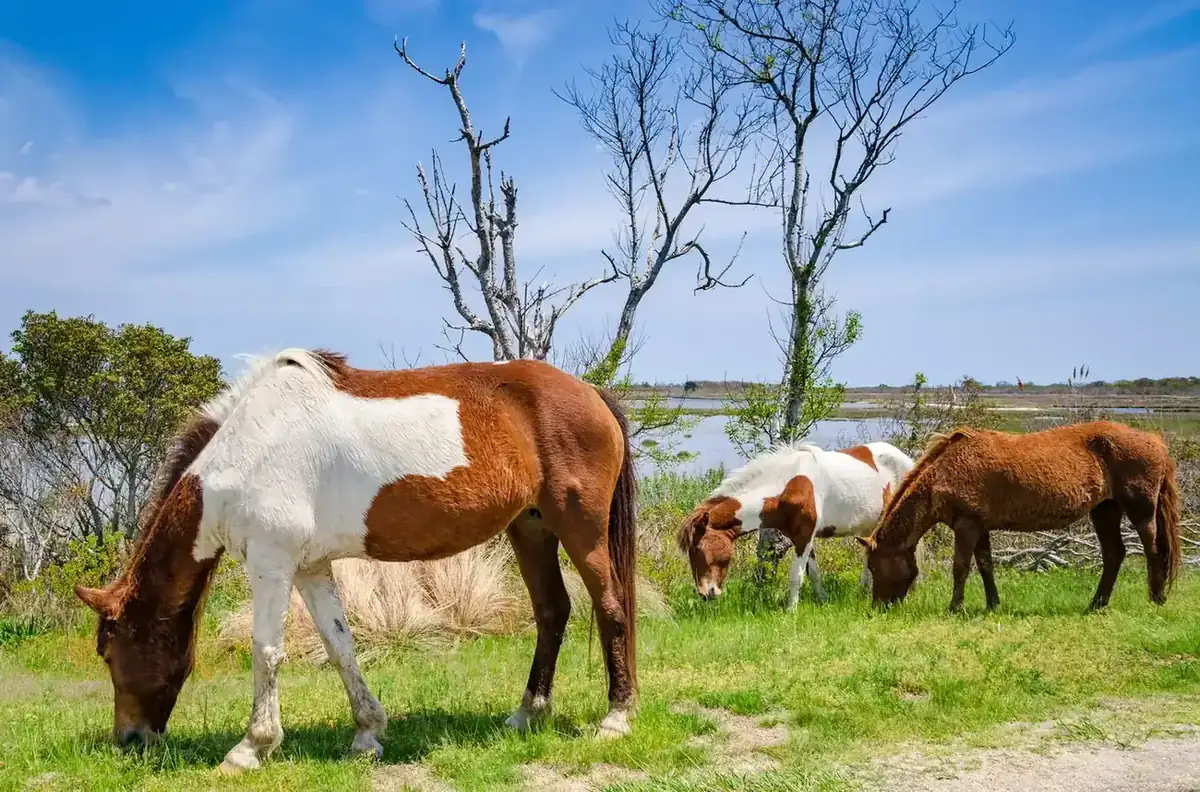
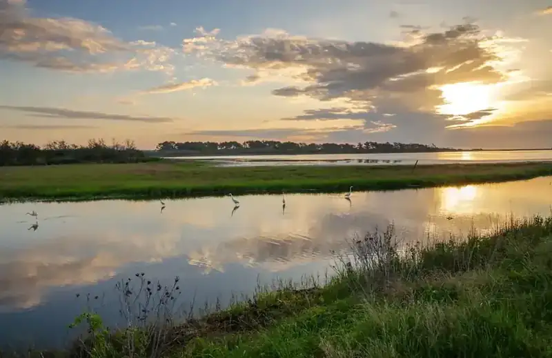
One of the last remaining, mostly undisturbed tracts of land is the 37 mile long Assateague Island, off the coast of Maryland and Virginia. This barrier island, isolated from the mainland, displays the east coast's full variety of beaches, forests, and wetlands all in one location. One of the unique features of the wetlands is that they slowly migrate over time as the ocean reshapes the island. There are trails with elevated boardwalks extending over the marshes, to allow visitors to get up close and observe the native plants and animals. This includes the Assateague's most famous residents — its charming wild horses (actually feral descendants of once domesticated herds). The area is also home to over 300 bird species.
The island was originally slated for development similar to the beach homes and tourist communities along the Outer Banks in North Carolina. However, the Ash Wednesday Storm of 1962 foiled the plans for development when it destroyed most existing structures on the island. The storm gave Assateague Island a second lease on life when the lands were sold to the federal government.
The bulk of Assateague is currently a National Seashore, which is one of the two strangest and most outdated National Park Service designations. There are 10 National Seashores and 3 National Lakeshores, which were all created between 1953 and 1975. These designations were largely created as a way to semi-protect these areas without the controversy of full National Park status. Seashore and Lakeshore sites are all situated along America's waterfronts and most resemble what would typically be considered recreation areas, with beaches, lighthouses, and small tourist attractions.
The section of the island located in Virginia is managed as Chincoteague National Wildlife Refuge, which is another protective federal designation. I believe that the whole of Assateague Island should be elevated to full-fledged National Park status due to its locations and unique landscapes. This would create a series of coastal National Parks along the east coast that would finally highlight the full diversity of its natural splendor.
The history of National Park Campaigns
Assateague was identified as a national-seashore candidate in the NPS's 1934 coastal survey and championed legislatively from 1940 by Rep. Schuyler Otis Bland, whose Rehoboth–Assateague bills repeatedly died. After private subdivision (Ocean Beach), the March 1962 Ash Wednesday storm, and a 1963 Interior/BOR study, Congress created Assateague Island National Seashore on Sept. 21, 1965 (P.L. 89-195). Notably, the debate was always framed as a national seashore/recreation area, never a National Park.
- Distinct National Park attempts
- 0 (always seashore/recreation-area framed)
- Other designation attempts
- many — Bland seashore bills across six Congresses (1940–49), 1943 refuge, 1940/1952/1956 state-park actions, 1963 bills, 1965 enactment, 1975 amendment
Sources
- Barry Mackintosh, Assateague Island National Seashore: An Administrative History (NPS History Division, 1982)
- Senate Hearing 89 (S. 20/S. 1121)
- House Hearings (H.R. 2701)
- Senate Report 331
- House Report 893
- NPS, Assateague Island National Seashore: A Proposal (1965)
- Robert R. Nathan Associates, "Impact of Development of Assateague Island."
- 1934
NPS national seashore survey. Per Barry Mackintosh, Assateague Island NS: An Administrative History (NPS, 1982), Ch. 1: "Assateague Island and the adjacent mainland comprised one of 12 areas found to qualify for such status by virtue of their natural qualities, recreational values, and propinquity to major populations. (Cape Hatteras, the first area subsequently established as a national seashore, was another.)"
- Sept. 1938
specific NPS report by Victor H. Cahalane, Harry T. Thompson, Merel Sager, and Wendell Little on the coast between Rehoboth, DE, and Chincoteague, VA. Conrad Wirth: "The 34-mile strip between Ocean City and Fishing Point could be preserved without any roads whatsoever."
- April 1940
Director Cammerer recommends to Secretary Ickes the "particular suitability of the Rehoboth–Assateague area for establishment as a national seashore"; Ickes approves further study.
- May 9, 1940
H.R. 9718 (76th Cong.), Rep. Schuyler Otis Bland (D-VA) — Rehoboth–Assateague National Seashore; up to 75,000 acres from Cape Henlopen, DE, to south Assateague; ≥half of lands/funds to be non-federal; towns of Rehoboth, Bethany Beach, Ocean City, and Chincoteague excluded. No House action; no Senate companion.
- 1941–1949
Bland reintroductions in the 77th, 78th, 79th, 80th, and 81st Congresses; all died. Bland's death in office (1950) ended the first legislative era.
- May 13, 1943
Chincoteague National Wildlife Refuge established (Fish and Wildlife Service) on the Virginia end (~9,000+ acres) — a competing federal designation funded by duck-stamp receipts.
- July 1947
NPS "Supplemental Report on the Proposed Rehoboth–Assateague National Seashore" scaled the proposal to ~12,700 acres (DE) + 7,300 (MD).
- 1940 & 1952
Maryland state-park proposals for Assateague, both without result; 1956 — Assateague State Park established after Leon Ackerman's North Ocean Beach donation of 540 acres.
- 1955
NPS coastal re-survey (Mellon Foundation–funded, 18-month study of 126 areas) judged the MD portion largely precluded by the Ocean Beach development.
- March 6, 1962
Ash Wednesday storm devastated the Ocean Beach subdivision (only ~16 cottages and 17 gun clubs survived), reviving federal interest and undoing the development that had discounted Assateague in 1955.
- April 1963
Interior/BOR joint study recommended an Assateague Island National Seashore over the whole island under the Park Service, keeping the state park and refuge as separate units; appended the Robert R. Nathan Associates report arguing against private-development feasibility. Local opposition (Worcester County, Ocean Beach lot owners led by Philip King) was intense; Udall, confronted on a June 24, 1963 site visit, reportedly shouted "If your attitude had prevailed there would be no National Park System."
- 1963 (88th Cong.)
first modern bills: H.R. 8371 (Rep. Clarence D. Long), H.R. 8385 (Rep. Carleton R. Sickles), H.R. 8755 (Rep. Rogers C.B. Morton, "The Morton Plan"), and S. 2128 (Sens. Daniel B. Brewster & J. Glenn Beall).
- 1965
enactment. S. 20 (89th Cong.) with companions (H.R. 2701 etc.); NPS published the promotional brochure Assateague Island National Seashore: A Proposal (early 1965); Senate hearings March 17–18, 1965 (on S. 20 and S. 1121); House hearings July 22–Aug. 16, 1965; Senate Report 331 (June 15, 1965); House Report 893 (Aug. 31, 1965). Signed by President Johnson Sept. 21, 1965 (P.L. 89-195, 79 Stat. 824), "for public outdoor recreation use and enjoyment."
- May 22, 1975
H.R. 7407 (94th Cong.) to repeal the road/overnight-accommodations provisions and require a comprehensive study before any wilderness designation — a management-fight bill.