- Location
- Texas
- Current protection
- Palo Duro Canyon State Park, Caprock Canyons State Park, Prairie Dog Town Fork Red River
- Status
- No active campaign
- In the book
- Featured in Undiscovered America
Why should it be a National Park?
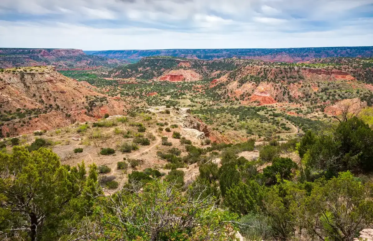
Palo Duro Canyon in the Texas Panhandle is the second largest canyon in America after the Grand Canyon, but few people have ever even heard of it, let alone know what it looks like. This canyon is located southeast of Amarillo and stretches 120 miles long and 18 miles wide. While dropping only 800 feet at its greatest depth, the terrain is made up of buttes and formations that extend throughout the massive canyon. The northern end of the canyon is maintained as Palo Duro Canyon State Park, while the southern end is Caprock Canyon State Park.
The entirety of Palo Duro Canyon and its interconnected ravines and formations make up over 800,000 acres of red desert. State parks only protect roughly 5.5% of the canyon, leaving America's second largest canyon unprotected. Most of the Texas Panhandle consists of flat grassland and ranches, making the red desert canyon a unique environment for the region.
The appearance of Palo Duro is both familiar and unusual. The orange and red earth is reminiscent of Arizona and Utah, while additional colors not typically associated with red rock environments provide a unique juxtaposition. These colorful elements mix with a combination of badlands like the ones found in the Dakota's as well as the buttes and mesas of New Mexico.
The first human habitation within the canyon boundary dates back over 10,000 years because of the reliable water source of the Prairie Dog Town Fork Red River. The Coronado Expedition brought the first Europeans to the region in 1541 during their exploration of the south central United States.
The Comanche and Kiowa tribes lived in and around the canyon at this time, but westward expansion became a threat on their land and their lives. The Red River War is a little-known military campaign to remove the native peoples from the plains and on September 28, 1874 the Battle of Palo Duro Canyon occurred. During the battle, Ranald S. Mackenzie led several U.S. Army regiments into the canyon and overturned the tribal camps. Many horses were killed and winter food supplies were decimated, driving the native peoples from their land. The canyon's largely untouched natural environment and the dark legacy of the Indian Wars gives Palo Duro Canyon an important story to tell in American history, making it all the more worthy of National Park status.
The history of National Park Campaigns
Palo Duro was proposed for federal protection at least six times: a 1906 booster resolution; Rep. John H. Stephens's "national forest reserve and park" bills of 1908, 1911, and 1915; the Park Service's 1934 vision of a one-million-acre "National Park of the Plains"; and a 1938–39 NPS re-study as a national monument. All failed on Texas's private-land problem and cost; the state park opened July 4, 1934, and the NPS-Texas cooperative master plan (1937–38) shaped it.
- Distinct National Park attempts
- 5 (1906; 1908; 1911; 1915; 1934) + 1 monument study (1938–39)
Sources
- Handbook of Texas, "Palo Duro Canyon State Park"
- TPW Magazine features (2016, 2018, 2025)
- NPS Region III files, "National Park of the Plains" (National Archives, RG 79)
- Peter L. Petersen, "A Park for the Panhandle," Panhandle-Plains Historical Review (1978) — VERIFY citation
- December 1906
Canyon City Commercial Club resolution for a National Park. (TSHA; prior research)
- 1908, 1911, 1915
Rep. John H. Stephens (D-TX) introduces national forest reserve and park bills; all fail amid Agriculture–Interior disputes and land-ownership problems. (TSHA)
- 1933
Texas buys land; July 4, 1934 — Palo Duro Canyon State Park opens; CCC builds it (1933–37).
- 1934
"NATIONAL PARK OF THE PLAINS." The NPS considers Palo Duro "a prime candidate for one of the nation's first ecosystem parks," proposed at ~1,000,000 acres; "land acquisition proved troublesome." (Texas Parks & Wildlife Magazine, July 2016, Apr. 2018; Caprock Canyoneer, citing National Archives)
- December 1937–January 1938
NPS "cooperating with" the Texas State Parks Board produces the Palo Duro Canyon State Park Master Plan.
- 1938–39
"The NPS conducted a second review of Palo Duro... considering it a candidate for a national monument... it failed to gain the needed support; more than anything, the cost seemed prohibitive." (TPW Magazine, July 2016)
- 1976
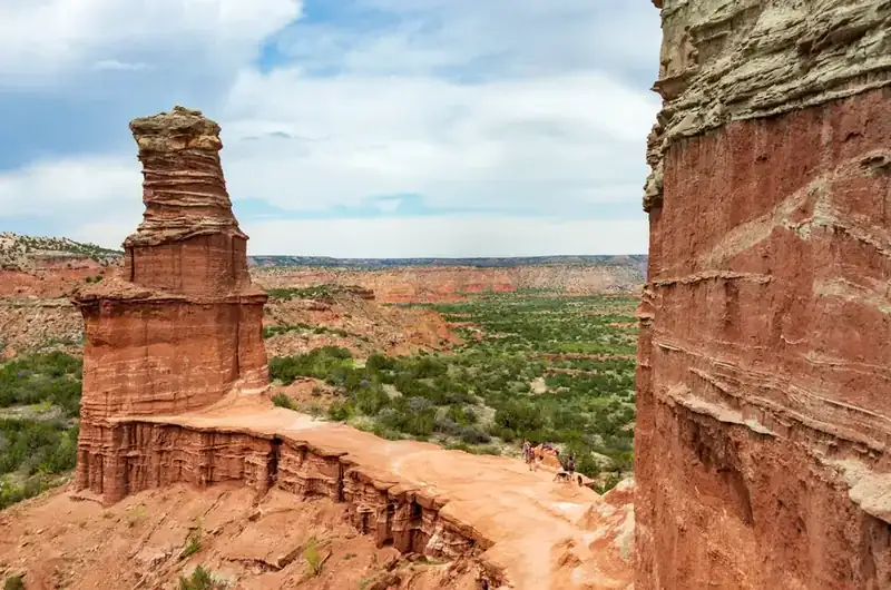
Palo Duro Canyon National Natural Landmark (Lighthouse).
- 2025
TPW Magazine recirculates the "National Park of the Plains" story; Rim Ranch conservation easement added. (2026 inventory)