- Location
- Arizona
- Current protection
- Tonto National Forest, Apache Trail, Superstition Wilderness
- Status
- No active campaign
- In the book
- Featured in Undiscovered America
Why should it be a National Park?
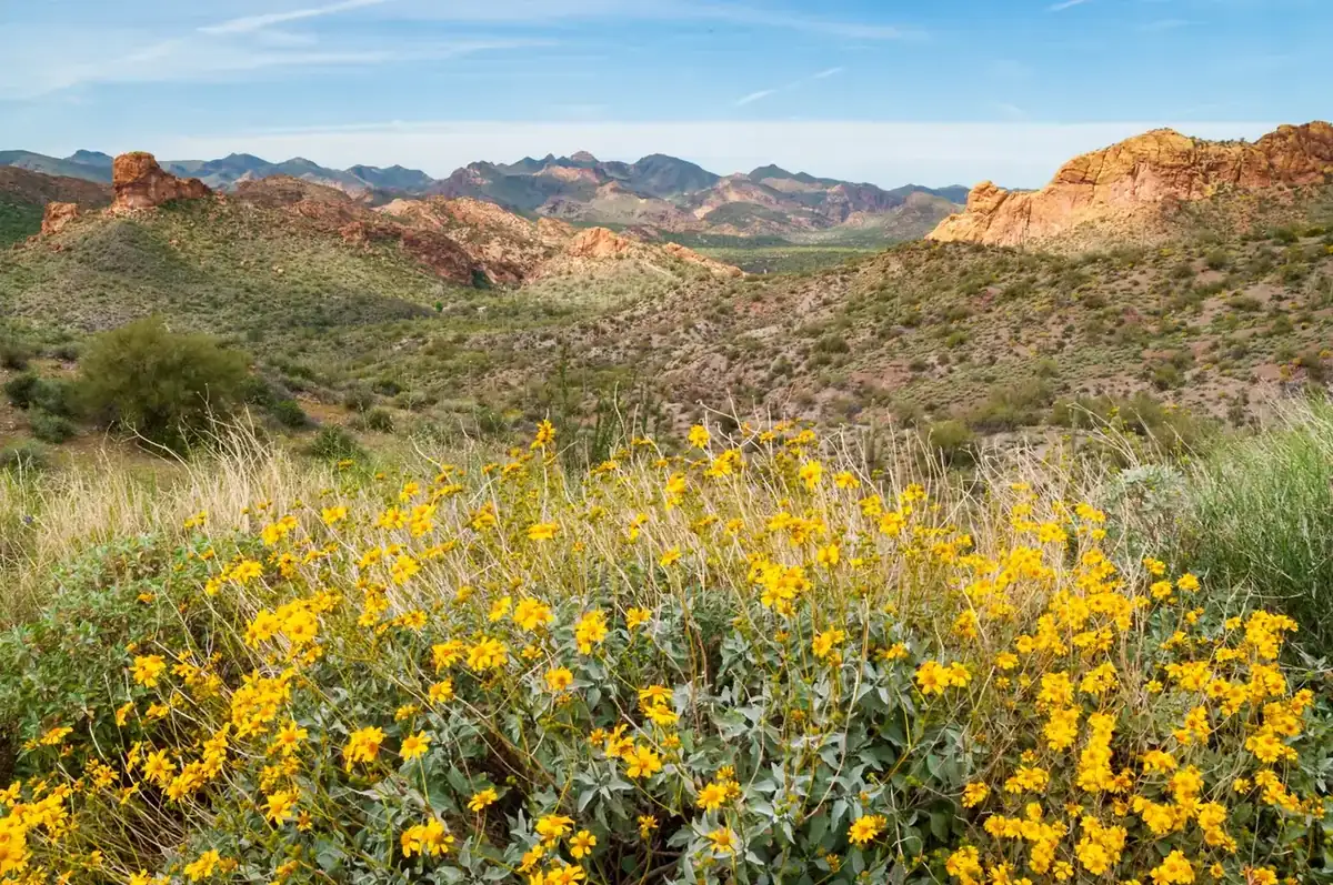
The Superstition Mountains are a starkly beautiful range of peaks and valleys located roughly 40 miles east of downtown Phoenix. The Sonoran Desert is inhospitable to those not equipped to meet nature on its own terms. Elevations range from 1,300 to 7,900 feet with wildly different animal and plant life found at different heights. Searing heat and a shortage of water are typical conditions in the summer. Bitter cold, rains, and even blizzards may occur in the winter.
When heading out into this landscape, most visitors stay close to State Route 88, better known as the Apache Trail. Construction of the trail began on August 29, 1903. The route follows an ancient footpath that is believed to have been used by Anasazi tribes to trade with the Hohokam people.
Apache Trail winds through steep terrain for 40 miles, linking Apache Junction at the edge of Greater Phoenix with Theodore Roosevelt Lake, through the Tonto National Forest. Much of the route, particularly east of Tortilla Flat, retains its original historic character with substantial sections remaining unpaved. Since there are many steep cliff drops but few safety barriers, the trail requires caution when driving and it is not recommended for large RVs, SUVs, or caravans. Some large RV rental companies do not allow their vehicles to be taken on this route.
The remote and barren landscape provides a feeling of experiencing the 'Old West'. The Superstition Mountains are home to the western legend of the Lost Dutchman's Gold Mine. According to this legend, a man named Jacob Waltz discovered a massive gold deposit in the mountains. Today, these rumors fuel a cottage industry of selling treasure maps to unprepared fortune seekers. The tale has also helped to define the area with a state park named 'Lost Dutchman' protecting a prominent mesa at the southwestern edge of the mountains. Also, the nearby Weavers Needle rock formation features as a landmark in the tale of the search for gold.
Along the road, you'll be able to enjoy recreational opportunities throughout the year, whether it's lake beaches or cool pine forests. South of Apache Trail is the Superstition Mountains Wilderness. It contains approximately 160,200 acres with a well-developed trail system. Trail conditions vary from fair to very poor, and several trails are unsuitable for horses.
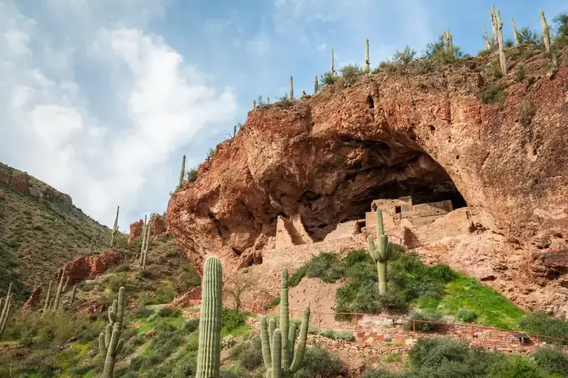
At the eastern extreme of the mountains is the ruins complex at Tonto National Monument. These cliff-side dwellings are an isolated but worthwhile attraction. Along with Roosevelt Dam, this area showcases the man-made wonders that accompany the mountains and their rugged appearance. This is a largely untamed region and structures like these create a shocking contrast to the barren and unrelenting desert.
The history of National Park Campaigns
No National Park or monument has ever been proposed for the range; protection came through the Forest Service (Superstition Primitive Area 1939 → Superstition Wilderness 1964, expanded 1984), Tonto National Monument (1907) for the cliff dwellings, and Lost Dutchman State Park (1977).
- Distinct National Park attempts
- 0
- Other designation attempts
- monument 1907; primitive area 1939; wilderness 1964/1984; state park 1977
Sources
- Tonto NF history
- Arizona Wilderness Act (P.L. 98-406) legislative history
- 1905
Tonto National Forest; December 19, 1907 — Tonto National Monument (Roosevelt) for the Salado cliff dwellings.
- 1911
Roosevelt Dam completed; Apache Trail built (1905).
- 1939
Superstition Primitive Area (USFS) designated; September 3, 1964 — becomes one of the Wilderness Act's original units; 1984 — Arizona Wilderness Act expands it to ~160,000 acres.
- 1977
Lost Dutchman State Park.
- 2019
Woodbury Fire; Apache Trail (SR-88) closure between Fish Creek Hill and Apache Lake (still closed as of 2026 — VERIFY).